Les Sauvages is a permanently submerged ,former upland that rose above the , lying about 20 miles southeast of Jersey, in the Channel Islands. Placed between two archipelago groups that vary enormously in size due to the tidal range, this geological anomaly could easily be overlooked. A map of 1693 shows Les Minquiérs, the Soaurde and Sauvage, warning vessels of the jagged rocks that lurk close to the surface. (Chambers et al. (2016) Les Minquiérs A Natural History, Charonia).
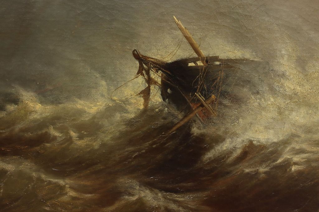
Strong currents carry plankton and minerals across the reef into the Bay of Granville as the surging tide tries to find an outlet, blocked against any further eastern advancement.
Placed between two archipelago groups that vary enormously in size due to the tidal range, this geological anomaly could easily be overlooked. A map of 1693 shows Les Minquiérs, the Soaurde and Sauvage, warning vessels of the jagged rocks that lurk close to the surface. (Chambers et al. (2016) Les Minquiérs A Natural History, Charonia).
Strong currents carry plankton and minerals across the reef into the Bay of Granville as the surging tide tries to find an outlet, blocked against any further eastern advancement.
The name “Sauvage” means “wild” in French, reflecting its rugged, unspoiled nature. According to history and legend, countless vessels met their end in the turbulent waters suggesting the name was more of a warning than a reference to its natural history.
Even the most up to date charts fail to depict the true topology that contributes to its unpredictable character. It is only through recent efforts to map the seabed with advanced side-scan sonar, that we now know the reef is actually a parallel pair of sunken ridges, separated by a wide coarse sand and shell fragment valley.
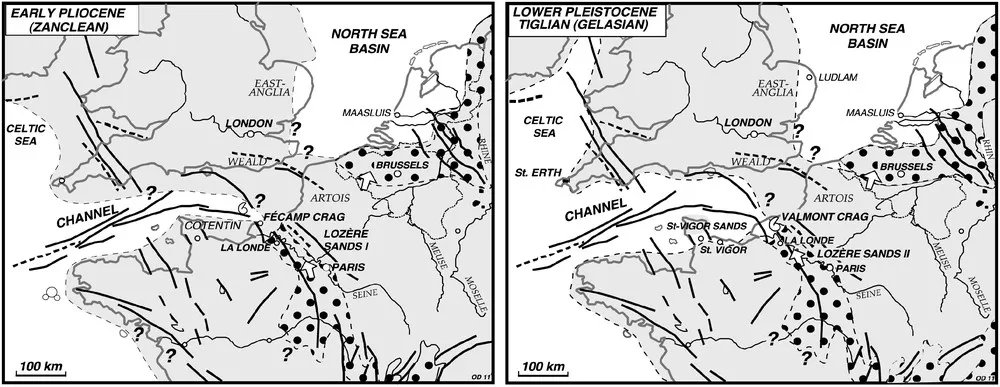
(Dugué, O. & Lautridou, J.P. & Quesnel, Florence & Clet-Pellerin, Martine & Poupinet, N. & Bourdillon, C.. (2009). The Cenozoic (Paleocene to lower Pleistocene) sedimentary evolution of the Normandy. Quaternaire. 20).
The reef supplied subsidiary streams feeding into major river systems meandering to an ocean that during glacial periods lay 30 miles or more to the west. Loess (windblown sand) covered much of the surrounding plain and even the upland. It is likely that the reef at that time provided grazing and fresh water as well as shelter. Sites such as La Cotte discovered in Jersey suggest migratory herds and neolithic hunters could have exploited the ridge and used caves for nomadic shelter.
(Billard, C., Daire, MY., Martin, C. (2020). France: Submerged Prehistory on Atlantic and Mediterranean Coasts. In: Bailey, G., Galanidou, N., Peeters, H., Jöns, H., Mennenga, M. (eds) The Archaeology of Europe’s Drowned Landscapes. Coastal Research Library, vol 35. Springer)
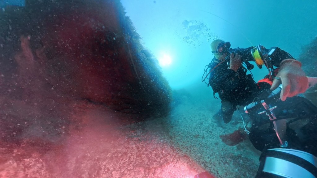
Slopes rise gradually from the southern seabed fringe to a north facing escarpment topped by Kelp, which overlooks gullies and overhangs. Wide terraces step down, often interspersed by sloping boulder fields. Across the valley, the slope rises once more to end suddenly on the northern escarpment, before plunging down steeply to a rim of large boulders that end abruptly, submitting to an undulating coarse sediment seabed that extends into the distance.
JMC examined the limited Seasearch reports made in the 1990s and chose the Sauvage Reef as a key conservation building on the marine and biological findings from the 2012 and 2013 surveys. Since then, we have made numerous survey dives, progressively extending species records, knowledge of the habitats and a geological understanding of the reefs structure.
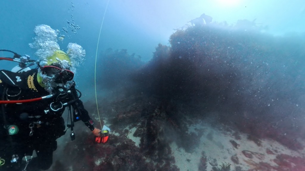
A fault line runs from approximately north to south about 2/3 of the way along the reef when travelling eastwards. This area is still requiring exploration with rumoured petrified wood, a stream bed and further cave sites. Off the east end of the reef bounded by the SE Minquiérs Sauvage Buoy, there is a steep walled pinnacle.
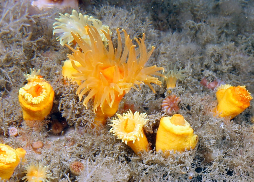
The surveys conducted by Seasearch in the 1990’s, highlighted the topology associated with similar terrestrial outcrops that include steep walls and overhangs. A species of coral known as Eunicella verrucosa and a translucent yellow anemone; Leptopsammia pruvoti were particularly noted particularly, providing an ideal underwater photography opportunity.
Organising survey expeditions has proved challenging since opportunities are dictated by tides, weather, level of diving expertise and availability of a suitable vessel.
JMC organised visits to the reef annually from 2012, helped by grants and funds. We subsequently played a key role in augmenting the Blue Marine Foundation (BMF) expeditions to the reef. Sadly, the published report appears devoid of the level of contribution made by JMC.
Th early surveys helped formulate Jersey’s Marine Protected Areas policy that came into force after much discussion and consideration in October of 2026 and we are very proud of the role played by our team.
A number of unique or threatened species were recorded on the escarpment and JMC submitted a recommendation that some form of protection should be considered withing the Revised Wildlife Law framework.
BMF contacted JMC in 2017 and asked for assistance in the planning of an expedition to gather evidence and JMC divers shared their knowledge and played a key role in the dives. A snapshot summary was published outlining why the reef should be part of Jersey’s marine protection policy. The campaigns by both organisations have ensured that the Sauvage is part of Jersey’s Marine Spatial legislation.
https://www.bluemarinefoundation.com/wp-content/uploads/2025/06/BlueMarine_LesSauvages_FinalBaselineReport_sep23-1.pdf
The impacts of fishing on the reef are clearly identifiable. Around the fringes the boulder field has been displaced, removing long-established Seafan Communities that functioned as lattices for ray and shark embryos.
Potting has targeted the Crawfish population, wiping out most of the breeding population. Vast amounts of ghost pots and rope remain testament to the difficulty of placing the trap strings along the escarpment. Modern sonar equipment has guided the mobile gear operators into the central valley to target lucrative species and as a result the remaining animal turf communities are limited in type and abundance.
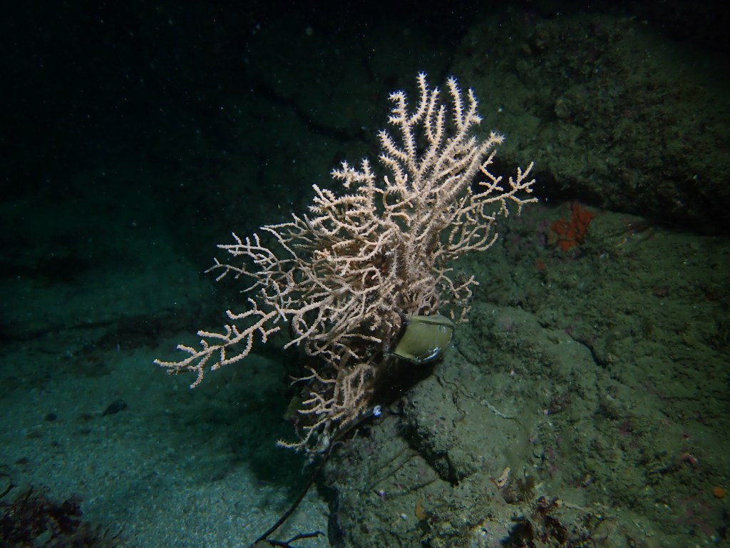
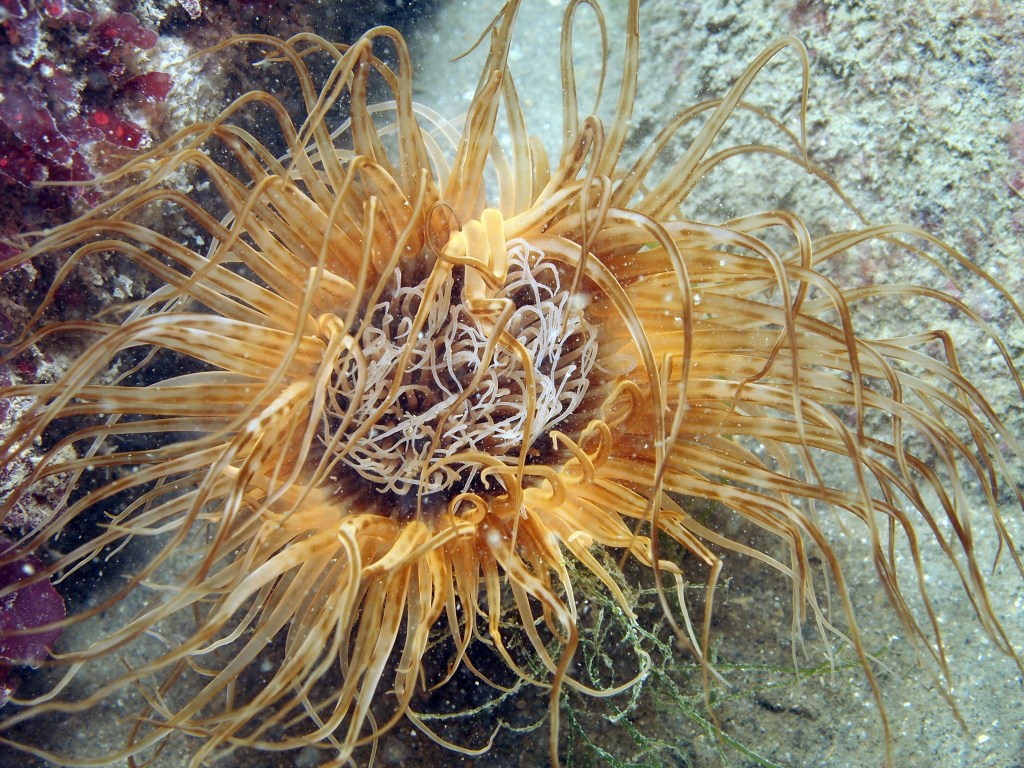
Potting rope and mobile gear has dislodged the Seafans and the resulting imbalance in trophic levels has created vulnerability through over grazing. 25% of the surveyed mature gorgonians are at the limit of survivability.
Protection against the loss of key species is urgently required and the proposal for the Sauvage to become Jersey’s second No Take Zone is a major step towards long-term habitat recovery.
SURVEYING THE REEF
For 15 years no diving or independent scientific vessels went to Sauvage. Thankfully Wreck & Reef charters agreed to provide their diving vessel ‘Magic’ and expeditions resumed. It was a long trip to make one dive. The vessel offered comfort and protection against the rough seas that sprang out of nowhere as the tide turned and wind shifted.
The vessel reduced operations and JMC raised funds to purchase our own vessel Seahorse that had the capability to reach the reef site.
As JMC’s knowledge of the currents and seabed relief grew we realised that with careful positioning two dives could be made and subsequently the area of exploration expanded south and east across the reef.
Our early discoveries illustrated that we had stumbled across a feature that if visible would be a special scientific feature, sitting alongside places like Harrisons Rocks in Kent or Bude in Cornwall
Piotr Migoń P., 2021 Sandstone geomorphology – Recent advances, Geomorphology, Volume 373.
On a day of good underwater visibility, it is easy to imagine the central valley devoid of water. Rounded stones show stream rather than tidal erosion. Overhangs and caves reveal stunning carpets of Sunset Cup corals. Draped down the walls multi-coloured Jewel anemones add to the overwhelming feeling that this really is a special place.
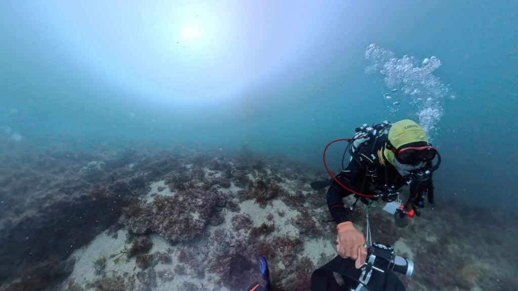
In the last 4 years JMC has visited to site on any favourable opportunity. Much of the western section has been surveyed using Dive Propulsion vehicles and 360° cameras, even in challenging currents.
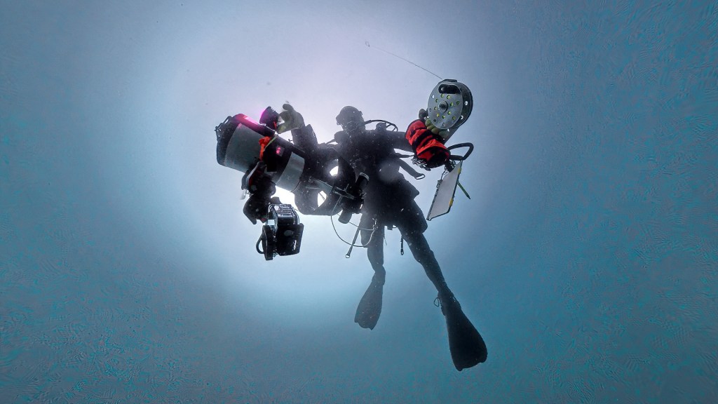
This year in conjunction with Jersey Marine Resource we have placed BRUVs (baited underwater videos enabling a Jersey International Centre student to study mobile species around the reef. eDNA samples that will give us a more comprehensive indication of associated species is being analysed by Exeter’s, Hatherley labs.
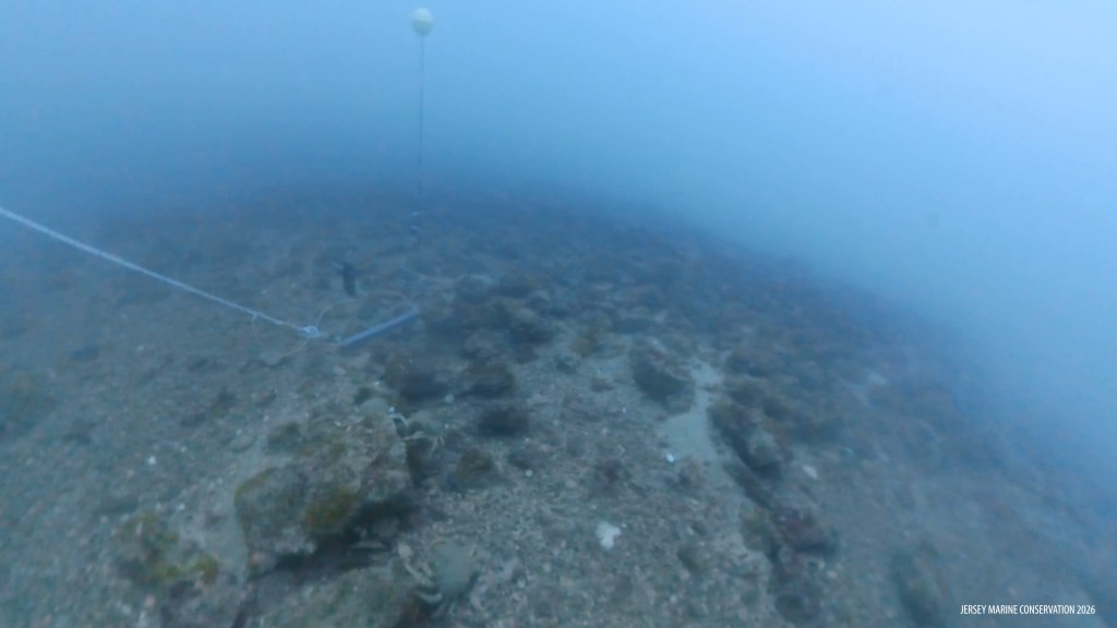
In preparation for the NTZ debate we have also surveyed the nearby Souarde Reef. We are grateful for the help and support of Phil Sayes and his survey vessel Marathon assisted by Mike Sheldon. Although impressive and of species importance key species are far more limited in abundance and community strength.
The saying often quoted is: Out of sight is out of mind.’ Our videos and photos demonstrate that over exploitation is both harmful and unsustainable. The diminishing value of species harvesting has led to a decline in commercial fishing of the Sauvage. Currently only juvenile examples represent the communities and the establishment of an NTZ is urgently required.
The reef still holds many secrets, offering scientific insights. The immediate protection will ensure we have the chance to investigate this iconic site that has been overlooked for far too long.
